
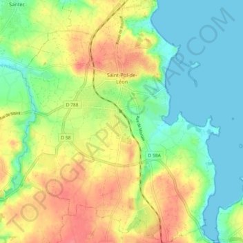
Saint-Pol-de-Léon topographic map
Interactive map
Click on the map to display elevation.
About this map
Name: Saint-Pol-de-Léon topographic map, elevation, terrain.
Average elevation: 85 ft
Minimum elevation: 0 ft
Maximum elevation: 194 ft
Das Gebiet des heutigen Saint-Pol war bereits in der Urgeschichte besiedelt. Funde zeugen von einer militärischen Präsenz der Römer im 3. Jahrhundert. Wie aus den ältesten Schriften hervorgeht, war der Ort von einem „Erdwall von beeindruckender Höhe“ umgeben.
Other topographic maps
Click on a map to view its topography, its elevation and its terrain.
Landerneau
Frankreich > Bretagne > Finistère
Landerneau, Brest, Finistère, Bretagne, Metropolitanes Frankreich, 29800, Frankreich
Average elevation: 285 ft
Les Quatres Vents
Frankreich > Bretagne > Finistère > La Forest-Landerneau > Les Quatres Vents
Les Quatres Vents, La Forest-Landerneau, Brest, Finistère, Bretagne, Metropolitanes Frankreich, 29800, Frankreich
Average elevation: 259 ft