
Glandwr topographic map
Interactive map
Click on the map to display elevation.
About this map
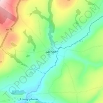
Name: Glandwr topographic map, elevation, terrain.
Location: Glandwr, Pembrokeshire, Wales, SA34 0XY, United Kingdom (51.90724 -4.65145 51.94724 -4.61145)
Average elevation: 554 ft
Minimum elevation: 246 ft
Maximum elevation: 1,165 ft