Geolocate

Panther topographic map

Click on the map to display elevation.

About this map
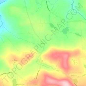
Name: Panther topographic map, elevation, terrain.

Location: Panther, Greene Township, Pike County, Pennsylvania, United States (41.26009 -75.31935 41.30009 -75.27935)

Average elevation: 1,686 ft

Minimum elevation: 1,319 ft

Maximum elevation: 2,113 ft

Pike County trails, hiking, mountain biking, running and outdoor activities

Gear up for your next adventure:

🔦LED Headlamp - Bright and durable LED headlamp for night navigation
📱Solar Portable Charger - Solar power bank for charging devices off‑grid
🥘Titanium Cookware - Durable, featherlight pots and pans for backpacking
🚪Portable Camp Chair - Foldable chair for comfort at camp
🧣Merino Neck Gaiters - Multi-functional headwear for wind and sun protection

As an Amazon Associate, this site earns from qualifying purchases at no extra cost to you.