
Make a donation
Gear up for your next adventure:
As an Amazon Associate, this site earns from qualifying purchases at no extra cost to you.
Khonj topographic map
Click on the map to display elevation.
Make a donation
Gear up for your next adventure:
As an Amazon Associate, this site earns from qualifying purchases at no extra cost to you.
Khonj
Khonj (Persian: خنج) is a city in the Central District of Khonj County, Fars province, Iran, serving as capital of both the county and the district. The city is at an altitude of 670 metres (2,200 ft). Khonj was traditionally part of the region of Irahistan.
Make a donation
Gear up for your next adventure:
As an Amazon Associate, this site earns from qualifying purchases at no extra cost to you.
About this map
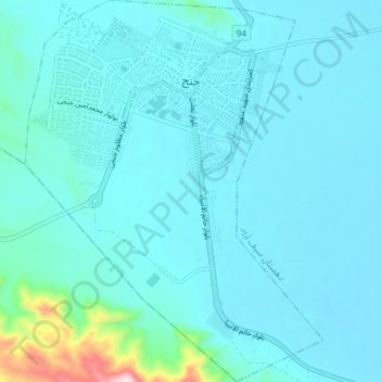
Name: Khonj topographic map, elevation, terrain.
Location: Khonj, بخش مرکزی, Khonj County, Fars Province, Iran (27.83824 53.40463 27.90372 53.46248)
Average elevation: 2,283 ft
Minimum elevation: 2,139 ft
Maximum elevation: 3,596 ft
Make a donation
Gear up for your next adventure:
As an Amazon Associate, this site earns from qualifying purchases at no extra cost to you.