
Aubusson topographic map
Interactive map
Click on the map to display elevation.
About this map
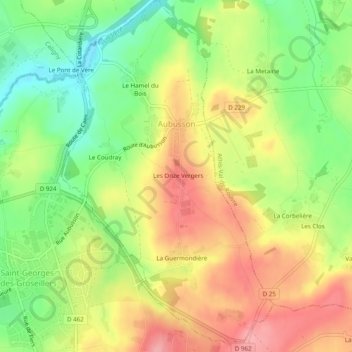
Name: Aubusson topographic map, elevation, terrain.
Average elevation: 732 ft
Minimum elevation: 551 ft
Maximum elevation: 909 ft
Other topographic maps
Click on a map to view its topography, its elevation and its terrain.
Les Bordeaux
Frankreich > Normandie > Orne > Planches
Les Bordeaux, Planches, Mortagne-au-Perche, Orne, Normandie, Metropolitanes Frankreich, 61370, Frankreich
Average elevation: 889 ft
Exmes
Frankreich > Normandie > Orne > Gouffern en Auge
Exmes, Gouffern en Auge, Argentan, Orne, Normandie, Metropolitanes Frankreich, 61310, Frankreich
Average elevation: 643 ft