
Ramgarh topographic map
Interactive map
Click on the map to display elevation.
About this map
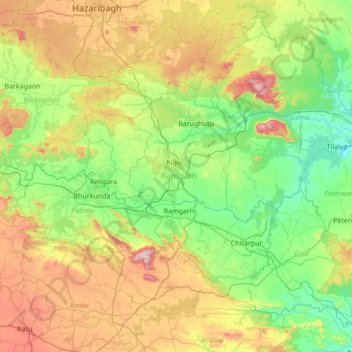
Name: Ramgarh topographic map, elevation, terrain.
Location: Ramgarh, Jharkhand, India (23.41896 85.19757 23.96425 85.88309)
Average elevation: 1,539 ft
Minimum elevation: 712 ft
Maximum elevation: 3,356 ft
Other topographic maps
Click on a map to view its topography, its elevation and its terrain.