Geolocate

Vagnas topographic map

Click on the map to display elevation.

About this map
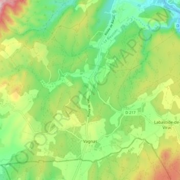
Name: Vagnas topographic map, elevation, terrain.

Location: Vagnas, Largentière, Ardèche, Auvergne-Rhône-Alpes, Metropolitan France, 07150, France (44.33826 4.30543 44.38746 4.38767)

Average elevation: 745 ft

Minimum elevation: 253 ft

Maximum elevation: 1,552 ft

Other topographic maps

Click on a map to view its topography, its elevation and its terrain.
La Chirouze

France > Auvergne-Rhône-Alpes > Ardèche > Saint-Christol

Average elevation: 2,559 ft

Gear up for your next adventure:

🎁Geography Themed Gifts - Unique gift ideas for map lovers and geography enthusiasts
🪶Survival Guide Book - Expert advice for emergency preparedness
📚USA Hiking Guide Books - Top trail guides and map books
🪶Camp Gear Gift Set - Perfect gift bundle for outdoor fans
📻Weather Alert Radios - Stay informed of storm risks while off-the-grid

As an Amazon Associate, this site earns from qualifying purchases at no extra cost to you.