
Rumtek topographic map
Interactive map
Click on the map to display elevation.
About this map
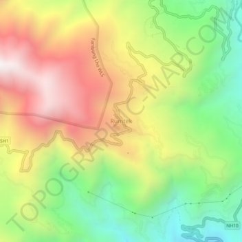
Name: Rumtek topographic map, elevation, terrain.
Location: Rumtek, Gangtok, East Sikkim District, Sikkim, 737102, India (27.26961 88.54223 27.30961 88.58223)
Average elevation: 4,508 ft
Minimum elevation: 2,388 ft
Maximum elevation: 6,923 ft