
Parc Ménobu topographic map
Interactive map
Click on the map to display elevation.
About this map
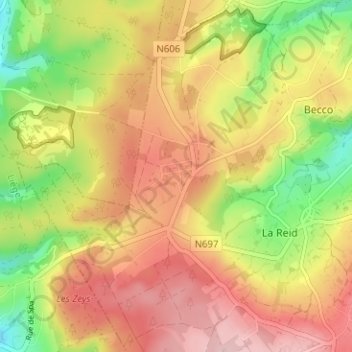
Name: Parc Ménobu topographic map, elevation, terrain.
Location: Parc Ménobu, La Reid, Theux, Liège, Wallonie, 4910, Belgique (50.47404 5.74726 50.51404 5.78726)
Average elevation: 1,063 ft
Minimum elevation: 735 ft
Maximum elevation: 1,329 ft