
Sivry topographic map
Interactive map
Click on the map to display elevation.
About this map
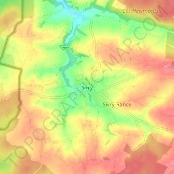
Name: Sivry topographic map, elevation, terrain.
Location: Sivry, Sivry-Rance, Thuin, Hainaut, Wallonie, 6470, Belgique (50.14790 4.15928 50.18790 4.19928)
Average elevation: 761 ft
Minimum elevation: 614 ft
Maximum elevation: 860 ft