
Keuka topographic map
Interactive map
Click on the map to display elevation.
About this map
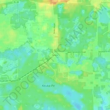
Name: Keuka topographic map, elevation, terrain.
Location: Keuka, Putnam County, Floride, 32148, États-Unis d'Amérique (29.58469 -81.93259 29.62469 -81.89259)
Average elevation: 92 ft
Minimum elevation: 46 ft
Maximum elevation: 161 ft