
Thank you for supporting this site ❤️
Make a donation
Make a donation
Gear up for your next adventure:
As an Amazon Associate, this site earns from qualifying purchases at no extra cost to you.
Maunça topographic map
Click on the map to display elevation.
Thank you for supporting this site ❤️
Make a donation
Make a donation
Gear up for your next adventure:
As an Amazon Associate, this site earns from qualifying purchases at no extra cost to you.
About this map
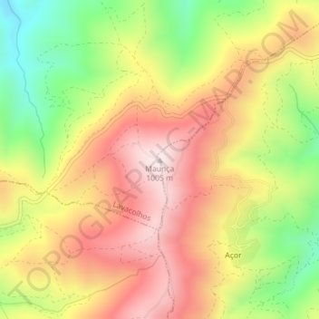
Name: Maunça topographic map, elevation, terrain.
Location: Maunça, Castelejo, Fundão, Castelo Branco, 6230-637, Portugal (40.09863 -7.64974 40.09873 -7.64964)
Average elevation: 2,523 ft
Minimum elevation: 1,608 ft
Maximum elevation: 3,294 ft
Thank you for supporting this site ❤️
Make a donation
Make a donation
Gear up for your next adventure:
As an Amazon Associate, this site earns from qualifying purchases at no extra cost to you.