
3rd District topographic map
Interactive map
Click on the map to display elevation.
About this map
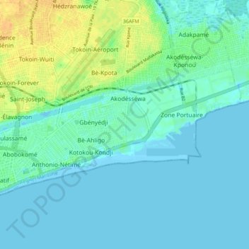
Name: 3rd District topographic map, elevation, terrain.
Location: 3rd District, Lomé, Togo (6.12567 1.22102 6.16386 1.30574)
Average elevation: 23 ft
Minimum elevation: -10 ft
Maximum elevation: 98 ft
Other topographic maps
Click on a map to view its topography, its elevation and its terrain.