

Sal topographic map
Click on the map to display elevation.
Sal
The island is 29.7 km long and 11.8 km wide. Its area is 219.84 km2 (84.88 sq mi). It is one of the three sandy eastern islands (Sal, Boa Vista and Maio) of the archipelago, with white sandy beaches. The island is fairly flat; its highest point is Monte Grande, at 406 m elevation. The uninhabited islet Ilhéu Rabo de Junco lies near the west coast of Sal. Saline marshes can be found in the Pedra de Lume crater and north of Santa Maria.
About this map
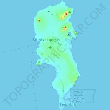
Name: Sal topographic map, elevation, terrain.
Location: Sal, Cape Verde (16.58499 -22.99434 16.85572 -22.87241)
Average elevation: 23 ft
Minimum elevation: -3 ft
Maximum elevation: 1,263 ft