

Fogo topographic map
Click on the map to display elevation.
Fogo
Fogo (Portuguese pronunciation: [ˈfoɡu]; Portuguese for "fire") is an island in the Sotavento group of Cape Verde in the central Atlantic Ocean. Its population is 35,837 (2015), with an area of 476 km2. It reaches the highest altitude of all the islands in Cape Verde, rising to 2,829 metres (9,281 feet) above sea level at the summit of its active volcano, Pico do Fogo.
About this map
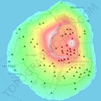
Name: Fogo topographic map, elevation, terrain.
Location: Fogo, São Filipe, Cape Verde (14.81225 -24.50453 15.05196 -24.27789)
Average elevation: 1,883 ft
Minimum elevation: 0 ft
Maximum elevation: 9,193 ft