
Karad topographic map
Interactive map
Click on the map to display elevation.
About this map
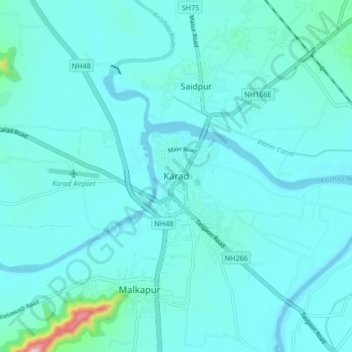
Name: Karad topographic map, elevation, terrain.
Location: Karad, Satara, Maharashtra, 415100, India (17.24521 74.14221 17.32521 74.22221)
Average elevation: 1,903 ft
Minimum elevation: 1,811 ft
Maximum elevation: 2,799 ft
Karad is located at 17°17′N 74°12′E / 17.28°N 74.2°E / 17.28; 74.2. It has an average elevation of 566 metres (1857 feet). Karad is located near Agashiva caves 17°14′15″N 74°09′07″E / 17.237506°N 74.15205°E / 17.237506; 74.15205.