
Saxen topographic map
Interactive map
Click on the map to display elevation.
About this map
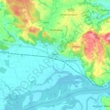
Name: Saxen topographic map, elevation, terrain.
Location: Saxen, Bezirk Perg, 4351, Österreich (48.17912 14.75251 48.23584 14.84031)
Average elevation: 892 ft
Minimum elevation: 728 ft
Maximum elevation: 1,414 ft
Other topographic maps
Click on a map to view its topography, its elevation and its terrain.
Markt-Süd
Österreich > Bezirk Perg > Pabneukirchen
Markt-Süd, Pabneukirchen, Bezirk Perg, 4363, Österreich
Average elevation: 1,860 ft