
Uibhist a Deas topographic map
Interactive map
Click on the map to display elevation.
About this map
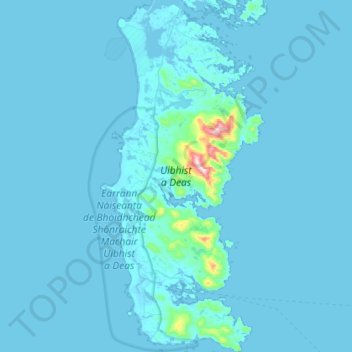
Name: Uibhist a Deas topographic map, elevation, terrain.
Location: Uibhist a Deas, Na h-Eileanan Siar, Escocia, Reino Unido (57.09553 -7.45826 57.40633 -7.19180)
Average elevation: 49 ft
Minimum elevation: -7 ft
Maximum elevation: 1,955 ft