
Thank you for supporting this site ❤️
Make a donation
Make a donation
Gear up for your next adventure:
As an Amazon Associate, this site earns from qualifying purchases at no extra cost to you.
Hasloh topographic map
Click on the map to display elevation.
Thank you for supporting this site ❤️
Make a donation
Make a donation
Gear up for your next adventure:
As an Amazon Associate, this site earns from qualifying purchases at no extra cost to you.
About this map
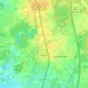
Name: Hasloh topographic map, elevation, terrain.
Location: Hasloh, Kreis Pinneberg, Schleswig-Holstein, 25474, Germany (53.67749 9.88498 53.71970 9.95266)
Average elevation: 72 ft
Minimum elevation: 30 ft
Maximum elevation: 118 ft
Thank you for supporting this site ❤️
Make a donation
Make a donation
Gear up for your next adventure:
As an Amazon Associate, this site earns from qualifying purchases at no extra cost to you.