
Ben-Ahin topographic map
Interactive map
Click on the map to display elevation.
About this map
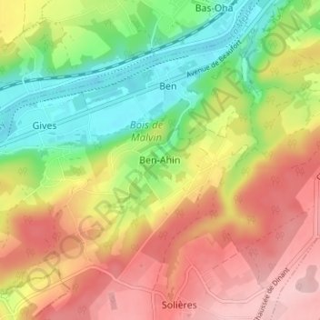
Name: Ben-Ahin topographic map, elevation, terrain.
Location: Ben-Ahin, Hoei, Luik, Wallonië, 4500, België (50.48332 5.15735 50.52332 5.19735)
Average elevation: 538 ft
Minimum elevation: 210 ft
Maximum elevation: 873 ft