
Quill topographic map
Interactive map
Click on the map to display elevation.
About this map
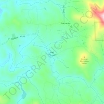
Name: Quill topographic map, elevation, terrain.
Location: Quill, Gilmer County, Géorgie, États-Unis d'Amérique (34.62287 -84.32020 34.66287 -84.28020)
Average elevation: 1,873 ft
Minimum elevation: 1,598 ft
Maximum elevation: 2,680 ft