
Jay topographic map
Interactive map
Click on the map to display elevation.
About this map
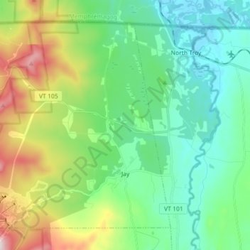
Name: Jay topographic map, elevation, terrain.
Location: Jay, Orleans County, Vermont, 05859, États-Unis d'Amérique (44.92612 -72.55388 45.00883 -72.41257)
Average elevation: 1,175 ft
Minimum elevation: 502 ft
Maximum elevation: 2,930 ft