
Cane Savannah topographic map
Interactive map
Click on the map to display elevation.
About this map
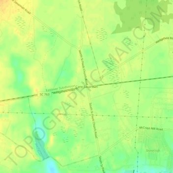
Name: Cane Savannah topographic map, elevation, terrain.
Location: Cane Savannah, Sumter County, South Carolina, 29154, USA (33.88182 -80.47036 33.92182 -80.43036)
Average elevation: 177 ft
Minimum elevation: 121 ft
Maximum elevation: 207 ft