
East Wakefield topographic map
Interactive map
Click on the map to display elevation.
About this map
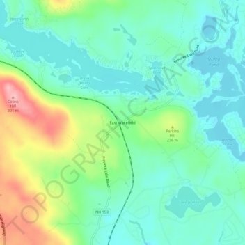
Name: East Wakefield topographic map, elevation, terrain.
Average elevation: 676 ft
Minimum elevation: 538 ft
Maximum elevation: 1,014 ft
Other topographic maps
Click on a map to view its topography, its elevation and its terrain.
Union
United States > New Hampshire > Carroll County > Wakefield
Union, Wakefield, Carroll County, New Hampshire, 03887, United States
Average elevation: 577 ft
Sanbornville
United States > New Hampshire > Carroll County > Wakefield
Sanbornville, Wakefield, Carroll County, New Hampshire, 03872, United States
Average elevation: 607 ft