
Rieux topographic map
Interactive map
Click on the map to display elevation.
About this map
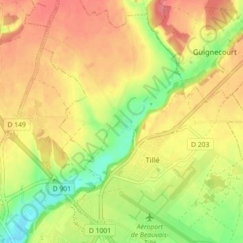
Name: Rieux topographic map, elevation, terrain.
Average elevation: 367 ft
Minimum elevation: 246 ft
Maximum elevation: 456 ft
Other topographic maps
Click on a map to view its topography, its elevation and its terrain.
Morlaine
France > Hauts-de-France > Oise > Tillé
Morlaine, Tillé, Beauvais, Oise, Hauts-de-France, France métropolitaine, 60000, France
Average elevation: 344 ft