
Bondhí topographic map
Interactive map
Click on the map to display elevation.
About this map
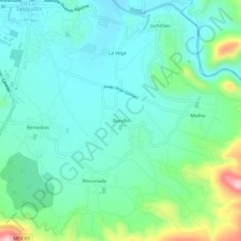
Name: Bondhí topographic map, elevation, terrain.
Location: Bondhí, Tasquillo, Hidalgo, 42380, México (20.51250 -99.31583 20.55250 -99.27583)
Average elevation: 5,551 ft
Minimum elevation: 5,344 ft
Maximum elevation: 6,250 ft
Other topographic maps
Click on a map to view its topography, its elevation and its terrain.
El Epazote
El Epazote, Tasquillo, Hidalgo, México
Average elevation: 5,702 ft