
Montánchez topographic map
Interactive map
Click on the map to display elevation.
About this map
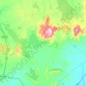
Name: Montánchez topographic map, elevation, terrain.
Location: Montánchez, Cáceres, Extremadura, Spanje (39.07058 -6.32151 39.29540 -6.07451)
Average elevation: 1,394 ft
Minimum elevation: 827 ft
Maximum elevation: 3,248 ft