Geolocate

Obertrubach topographic map

Click on the map to display elevation.

About this map

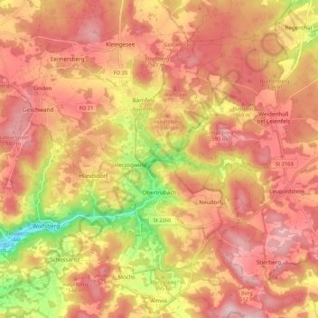
Name: Obertrubach topographic map, elevation, terrain.

Location: Obertrubach, Landkreis Forchheim, Bavaria, 91286, Germany (49.67824 11.27738 49.72645 11.38325)

Average elevation: 1,699 ft

Minimum elevation: 1,243 ft

Maximum elevation: 1,946 ft

Gear up for your next adventure:

🧴Hand Sanitizer - Keep hands clean while hiking
📡GPS Antenna Upgrade - Enhance GPS reception in remote terrain
🧭Compass with Lanyard - Easy‑carry compass for navigation
🏔️Mountain Trail Maps - High‑detail maps for popular peaks
📶Satellite Messenger - Communication device off‑grid

As an Amazon Associate, this site earns from qualifying purchases at no extra cost to you.