
Thank you for supporting this site ❤️
Make a donation
Make a donation
Gear up for your next adventure:
As an Amazon Associate, this site earns from qualifying purchases at no extra cost to you.
Heiden topographic map
Click on the map to display elevation.
Thank you for supporting this site ❤️
Make a donation
Make a donation
Gear up for your next adventure:
As an Amazon Associate, this site earns from qualifying purchases at no extra cost to you.
About this map
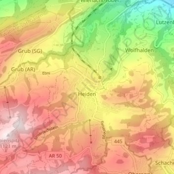
Name: Heiden topographic map, elevation, terrain.
Location: Heiden, Vorderland, Appenzell Ausserrhoden, 9410, Switzerland (47.42296 9.51449 47.46455 9.55889)
Average elevation: 2,690 ft
Minimum elevation: 1,450 ft
Maximum elevation: 3,645 ft
Thank you for supporting this site ❤️
Make a donation
Make a donation
Gear up for your next adventure:
As an Amazon Associate, this site earns from qualifying purchases at no extra cost to you.