
Crizbav topographic map
Interactive map
Click on the map to display elevation.
About this map
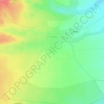
Name: Crizbav topographic map, elevation, terrain.
Location: Crizbav, Brașov, 507081, Romania (45.80334 25.45302 45.81887 25.48369)
Average elevation: 1,880 ft
Minimum elevation: 1,781 ft
Maximum elevation: 2,008 ft
The Crizbav commune altitude is 572 m, decreasing to Feldioara and Satu Nou at 513–514 m. Higher elevations in the commune are Horezu Peak-1055 m and Citadel Peak-1104 m, both arranged in the foothills of Perșani Mountains, approximately 6 km to the village center.