
Făgăraș topographic map
Interactive map
Click on the map to display elevation.
About this map
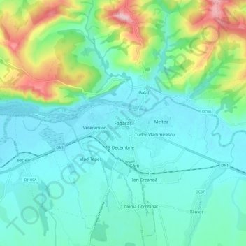
Name: Făgăraș topographic map, elevation, terrain.
Location: Făgăraș, Brașov, 505200, Romania (45.80494 24.93032 45.88494 25.01032)
Average elevation: 1,542 ft
Minimum elevation: 1,375 ft
Maximum elevation: 2,113 ft