
Thank you for supporting this site ❤️
Make a donation
Make a donation
Gear up for your next adventure:
As an Amazon Associate, this site earns from qualifying purchases at no extra cost to you.
Cogliate topographic map
Click on the map to display elevation.
Thank you for supporting this site ❤️
Make a donation
Make a donation
Gear up for your next adventure:
As an Amazon Associate, this site earns from qualifying purchases at no extra cost to you.
About this map
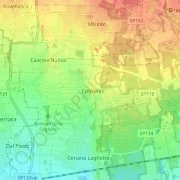
Name: Cogliate topographic map, elevation, terrain.
Location: Cogliate, Monza and Brianza, Lombardy, 20815, Italy (45.63561 9.05527 45.65541 9.12080)
Average elevation: 771 ft
Minimum elevation: 692 ft
Maximum elevation: 860 ft
Thank you for supporting this site ❤️
Make a donation
Make a donation
Gear up for your next adventure:
As an Amazon Associate, this site earns from qualifying purchases at no extra cost to you.