
Champoluc topographic map
Click on the map to display elevation.
Champoluc
It is one of the 3 main villages in the commune of Ayas, together with Antagnod (where the town hall is located) and Saint-Jacques. It lies at an altitude of 1568 meters in a broad flat part of the upper Ayas valley. Above Champoluc, to the East, is the Plan du Crest (1975 meters), one of the largest ski areas in the Aosta Valley, reachable by cable car from the centre of the village. In summer, the Crest is a popular place for hiking.
About this map
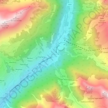
Name: Champoluc topographic map, elevation, terrain.
Location: Champoluc, Ayas, Aosta Valley, 11020, Italy (45.81164 7.70600 45.85164 7.74600)
Average elevation: 6,457 ft
Minimum elevation: 4,967 ft
Maximum elevation: 8,563 ft