
Thank you for supporting this site ❤️
Make a donation
Make a donation
Gear up for your next adventure:
As an Amazon Associate, this site earns from qualifying purchases at no extra cost to you.
Penedono topographic map
Click on the map to display elevation.
Thank you for supporting this site ❤️
Make a donation
Make a donation
Gear up for your next adventure:
As an Amazon Associate, this site earns from qualifying purchases at no extra cost to you.
About this map
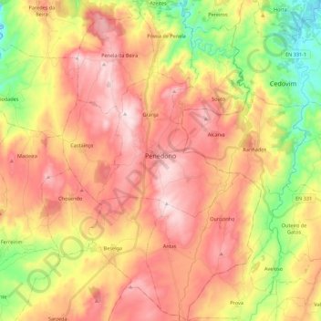
Name: Penedono topographic map, elevation, terrain.
Location: Penedono, Viseu, Douro, North, Portugal (40.90452 -7.46146 41.07013 -7.32527)
Average elevation: 2,421 ft
Minimum elevation: 1,427 ft
Maximum elevation: 3,268 ft
Thank you for supporting this site ❤️
Make a donation
Make a donation
Gear up for your next adventure:
As an Amazon Associate, this site earns from qualifying purchases at no extra cost to you.