

Visoko topographic map
Click on the map to display elevation.
Visoko
The Visoko municipality covers 232 square kilometres with several characteristic, morphologically distinctive valleys formed by the foothills of the Central Bosnian mountains including Ozren, Vranica and Zvijezda. The altitude of the region ranges from 400 to 1,050 metres. Visoko's natural environment is defined by the river-valleys of the Bosna and Fojnica rivers. The municipality borders the towns of Kiseljak, Busovača, Kakanj, Vareš, Breza, Ilijaš and Ilidža, and is connected by rail to the Adriatic coast.
About this map
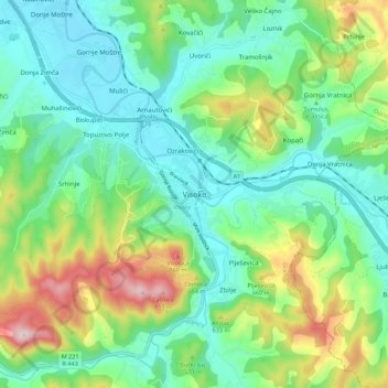
Name: Visoko topographic map, elevation, terrain.
Average elevation: 1,729 ft
Minimum elevation: 1,309 ft
Maximum elevation: 2,756 ft