
Ibahlal topographic map
Interactive map
Click on the map to display elevation.
About this map
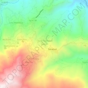
Name: Ibahlal topographic map, elevation, terrain.
Location: Ibahlal, Feraoun, Daïra Amizour, Béjaïa, 06330, Algérie (36.54041 4.84123 36.58041 4.88123)
Average elevation: 1,768 ft
Minimum elevation: 502 ft
Maximum elevation: 3,415 ft
Other topographic maps
Click on a map to view its topography, its elevation and its terrain.
Tizi
Algérie > Béjaïa > Daïra Amizour > Feraoun
Tizi, Feraoun, Daïra Amizour, Béjaïa, 06330, Algérie
Average elevation: 1,693 ft