Geolocate

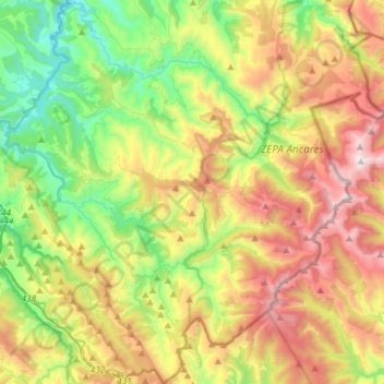
Cervantes topographic map

Click on the map to display elevation.

Cervantes

These elevations are located in the nearby mountain ranges of A Trappe, Lóuzara, O Oribio, O Rañadoiro and O Piornal .

Wikipedia (CC-BY-SA 3.0)

About this map

Name: Cervantes topographic map, elevation, terrain.

Location: Cervantes, Os Ancares, Lugo, Galicia, Spain (42.71869 -7.10979 42.93382 -6.83368)

Average elevation: 3,255 ft

Minimum elevation: 1,099 ft

Maximum elevation: 6,473 ft

Gear up for your next adventure:

🥾Women's Hiking Boots - Top-rated trail boots with ankle support and superior grip
🪶Multi‑Purpose Knife - Useful blade for camp and trail
🦶Carbon Trekking Poles - Reduce knee impact on steep descents with ultra-light poles
📚USA Hiking Guide Books - Top trail guides and map books
🥘Titanium Cookware - Durable, featherlight pots and pans for backpacking

As an Amazon Associate, this site earns from qualifying purchases at no extra cost to you.