
Kanpur topographic map
Interactive map
Click on the map to display elevation.
About this map
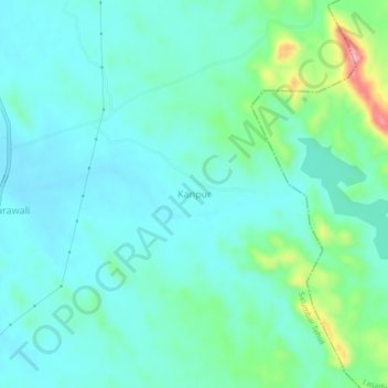
Name: Kanpur topographic map, elevation, terrain.
Average elevation: 1,119 ft
Minimum elevation: 1,007 ft
Maximum elevation: 1,555 ft
Other topographic maps
Click on a map to view its topography, its elevation and its terrain.
Isarwas Tapran
India > Rajasthan > Salumbar Tehsil > Isarwas
Isarwas Tapran, Isarwas, Salumbar Tehsil, Udaipur District, Rajasthan, 313027, India
Average elevation: 883 ft