
Steenokkerzeel topographic map
Interactive map
Click on the map to display elevation.
About this map
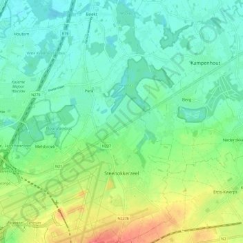
Name: Steenokkerzeel topographic map, elevation, terrain.
Location: Steenokkerzeel, Flemish Brabant, Flanders, 1820, Belgium (50.88908 4.45774 50.95942 4.53412)
Average elevation: 75 ft
Minimum elevation: 10 ft
Maximum elevation: 220 ft