
Grub topographic map
Interactive map
Click on the map to display elevation.
About this map
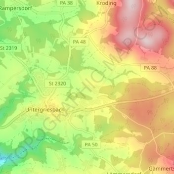
Name: Grub topographic map, elevation, terrain.
Location: Grub, Landkreis Passau, Bavière, 94107, Allemagne (48.55873 13.66253 48.59873 13.70253)
Average elevation: 1,801 ft
Minimum elevation: 1,217 ft
Maximum elevation: 2,379 ft