
Bebertal topographic map
Interactive map
Click on the map to display elevation.
About this map
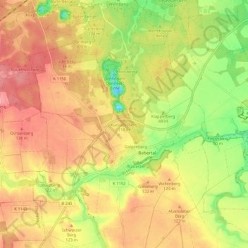
Name: Bebertal topographic map, elevation, terrain.
Location: Bebertal, Hohe Börde, Börde, Sachsen-Anhalt, Deutschland (52.21748 11.29054 52.28134 11.37363)
Average elevation: 354 ft
Minimum elevation: 164 ft
Maximum elevation: 499 ft