
Dudley Shoals topographic map
Interactive map
Click on the map to display elevation.
About this map
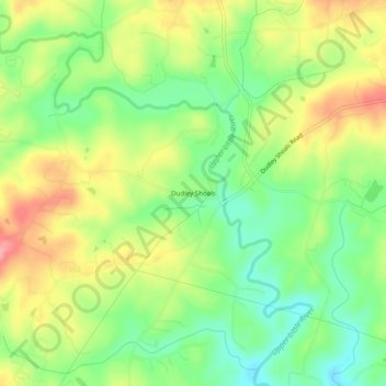
Name: Dudley Shoals topographic map, elevation, terrain.
Location: Dudley Shoals, Caldwell County, North Carolina, USA (35.84374 -81.39648 35.88374 -81.35648)
Average elevation: 1,158 ft
Minimum elevation: 1,007 ft
Maximum elevation: 1,345 ft