
Ouellé topographic map
Interactive map
Click on the map to display elevation.
About this map
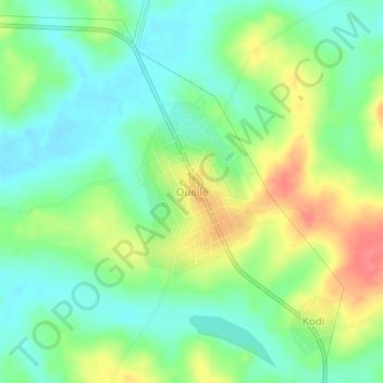
Name: Ouellé topographic map, elevation, terrain.
Location: Ouellé, Iffou, Lacs, 54, Côte d'Ivoire (7.27641 -4.03416 7.31641 -3.99416)
Average elevation: 627 ft
Minimum elevation: 541 ft
Maximum elevation: 768 ft