
Andamarca topographic map
Interactive map
Click on the map to display elevation.
About this map
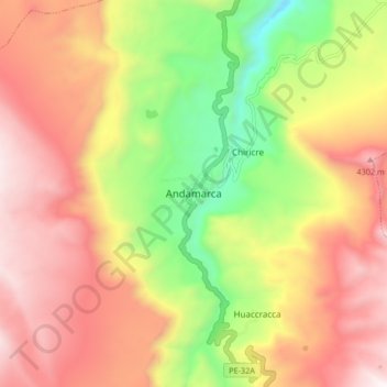
Name: Andamarca topographic map, elevation, terrain.
Location: Andamarca, Lucanas, Ayacucho, Pérou (-14.42757 -74.00200 -14.34757 -73.92200)
Average elevation: 12,707 ft
Minimum elevation: 10,456 ft
Maximum elevation: 14,646 ft