Geolocate

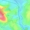
Ranrupt topographic map

Click on the map to display elevation.

About this map
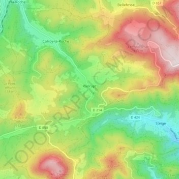
Name: Ranrupt topographic map, elevation, terrain.

Location: Ranrupt, Molsheim, Bas-Rhin, Grand Est, Metropolitan France, 67420, France (48.35022 7.15151 48.39536 7.24429)

Average elevation: 2,051 ft

Minimum elevation: 1,089 ft

Maximum elevation: 3,307 ft

Other topographic maps

Click on a map to view its topography, its elevation and its terrain.
Strasbourg

France > Grand Est > Bas-Rhin > Strasbourg

Average elevation: 505 ft

Ath

France > Grand Est > Bas-Rhin > Diemeringen

Average elevation: 837 ft

Taubensee

France > Grand Est > Bas-Rhin > Niederbronn-les-Bains

Average elevation: 1,299 ft

Le Haut des Monts

France > Grand Est > Bas-Rhin > Belmont

Average elevation: 2,785 ft

Le Climont

France > Grand Est > Bas-Rhin > Urbeis

Average elevation: 2,037 ft

Altenstadt

France > Grand Est > Bas-Rhin > Wissembourg

Average elevation: 564 ft

Gear up for your next adventure:

🗺️Topographic Maps - Detailed topo maps for hiking, exploring and outdoor navigation
👟Trail Running Shoes - Lightweight shoes for trail runners
🔦Powerful Headlamps - Ultra-bright hands-free lighting for night navigation
🎒Outdoor Daypacks - Lightweight backpacks designed for carrying maps and essential gear
🎒Waterproof Dry Bags - Keep your electronics and maps dry inside your pack

As an Amazon Associate, this site earns from qualifying purchases at no extra cost to you.