
Thank you for supporting this site ❤️
Make a donation
Make a donation
Gear up for your next adventure:
As an Amazon Associate, this site earns from qualifying purchases at no extra cost to you.
Huaypo topographic map
Click on the map to display elevation.
Thank you for supporting this site ❤️
Make a donation
Make a donation
Gear up for your next adventure:
As an Amazon Associate, this site earns from qualifying purchases at no extra cost to you.
About this map
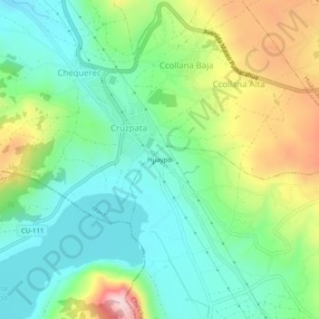
Name: Huaypo topographic map, elevation, terrain.
Location: Huaypo, Chinchero, Province of Urubamba, Cusco, Peru (-13.40769 -72.13298 -13.36769 -72.09298)
Average elevation: 11,834 ft
Minimum elevation: 11,460 ft
Maximum elevation: 12,608 ft
Thank you for supporting this site ❤️
Make a donation
Make a donation
Gear up for your next adventure:
As an Amazon Associate, this site earns from qualifying purchases at no extra cost to you.