
Parroquia Santa Rosa topographic map
Interactive map
Click on the map to display elevation.
About this map
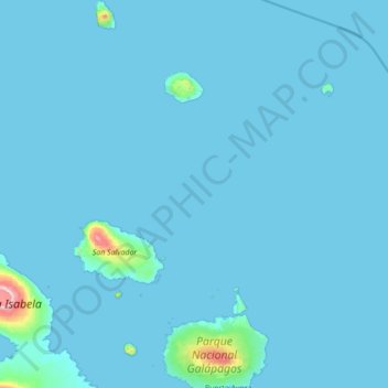
Name: Parroquia Santa Rosa topographic map, elevation, terrain.
Location: Parroquia Santa Rosa, Cantón Santa Cruz, Galápagos, Ecuador (-0.74894 -90.79031 0.64365 -90.23788)
Average elevation: 69 ft
Minimum elevation: 0 ft
Maximum elevation: 3,763 ft