
Märstetten topographic map
Interactive map
Click on the map to display elevation.
About this map
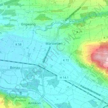
Name: Märstetten topographic map, elevation, terrain.
Location: Märstetten, Bezirk Weinfelden, Thurgau, 8560, Schweiz (47.57218 9.04844 47.60467 9.11070)
Average elevation: 1,473 ft
Minimum elevation: 1,342 ft
Maximum elevation: 2,057 ft
Other topographic maps
Click on a map to view its topography, its elevation and its terrain.
Bonau
Schweiz > Thurgau > Bezirk Weinfelden
Bonau, Wigoltingen, Bezirk Weinfelden, Thurgau, 8556, Schweiz
Average elevation: 1,447 ft
Weinfelden
Schweiz > Thurgau > Bezirk Weinfelden
Weinfelden, Bezirk Weinfelden, Thurgau, 8570, Schweiz
Average elevation: 1,621 ft