
Göstrup topographic map
Interactive map
Click on the map to display elevation.
About this map
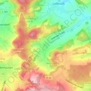
Name: Göstrup topographic map, elevation, terrain.
Location: Göstrup, Kreis Lippe, Nordrhein-Westfalen, Deutschland (52.07379 9.02034 52.11379 9.06034)
Average elevation: 751 ft
Minimum elevation: 433 ft
Maximum elevation: 1,106 ft