
Khorramdarreh City topographic map
Interactive map
Click on the map to display elevation.
About this map
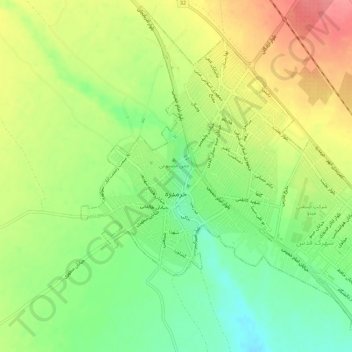
Name: Khorramdarreh City topographic map, elevation, terrain.
Average elevation: 5,217 ft
Minimum elevation: 5,095 ft
Maximum elevation: 5,348 ft
Other topographic maps
Click on a map to view its topography, its elevation and its terrain.
Khorramdarreh
Iran > Zanjan Province > Khoramdareh County > دهستان خرمدره
Khorramdarreh, دهستان خرمدره, بخش مرکزی, Khoramdareh County, Zanjan Province, Iran
Average elevation: 5,233 ft